Little-by-little we are getting closer to identifying the mystery hunter mentioned in previous posts. Already we have been able to identify his shikari (guide) as Rahima Lone, well-known for guiding the Roosevelt brothers and other prominent personalities in the early years of the 20th century. I have been reading the accounts of hunters and travellers who crossed the Pamirs during this period. Many have already been ruled out, due to their routes or intentions. However, today I made another little discovery that may help find our elusive trophy-hunter.
In 1941 a 19-year-old Norwegian apprentice called Wilfred Skrede decided he would make his way from Oslo to the training camp for the Norwegian Air Force at Little Norway in Toronto, Canada. His route was unusual, in that he went across Russia and Siberia before heading south through Xinjiang, across the Taklamakan Desert, then across the Karakorums and Himalayas to Kashmir, and thence from Mumbai via a ship to Singapore and then New York.
Some years after the war, in 1954, he published an account of his journey in English, called Across the Roof of the World (Staples Press, London, 1954). Looking through the book today I was struck by one photograph in particular entitled ‘Kazaks on the way to Kuldsha‘. Here is its:
Photo from Skrede’s book
As soon as I checked with my collection of 87 slides from the hunter’s journey I realised it was identical to one of them, as you can see below:
One of the hunter’s slides, identical to that used by Skrede
The Skrede photo is credited to the Royal Geographical Society in London. The hunter’s slide has a different caption, ‘A yurt on the Pamirs‘, but is otherwise identical. My guess is that this caption is more accurate that that of the Skrede photo. The ‘Kuldsha’ (actually Kuldja and now known as Yining) he mentions is a long way to the north in the Ili Valley and it would have been out of sequence amongst other slides of Hunza and Kashgar. Skrede used none of his own photographs in his book, but used several from the RGS and others by Sir CP Skrine and Col R Meinertzhagen. Presumably the RGS gave him permission to use a slide already in their collection. So the next job is to find out if the RGS can identify the slide and then, presumably, the identity of the photographer. Watch this space…
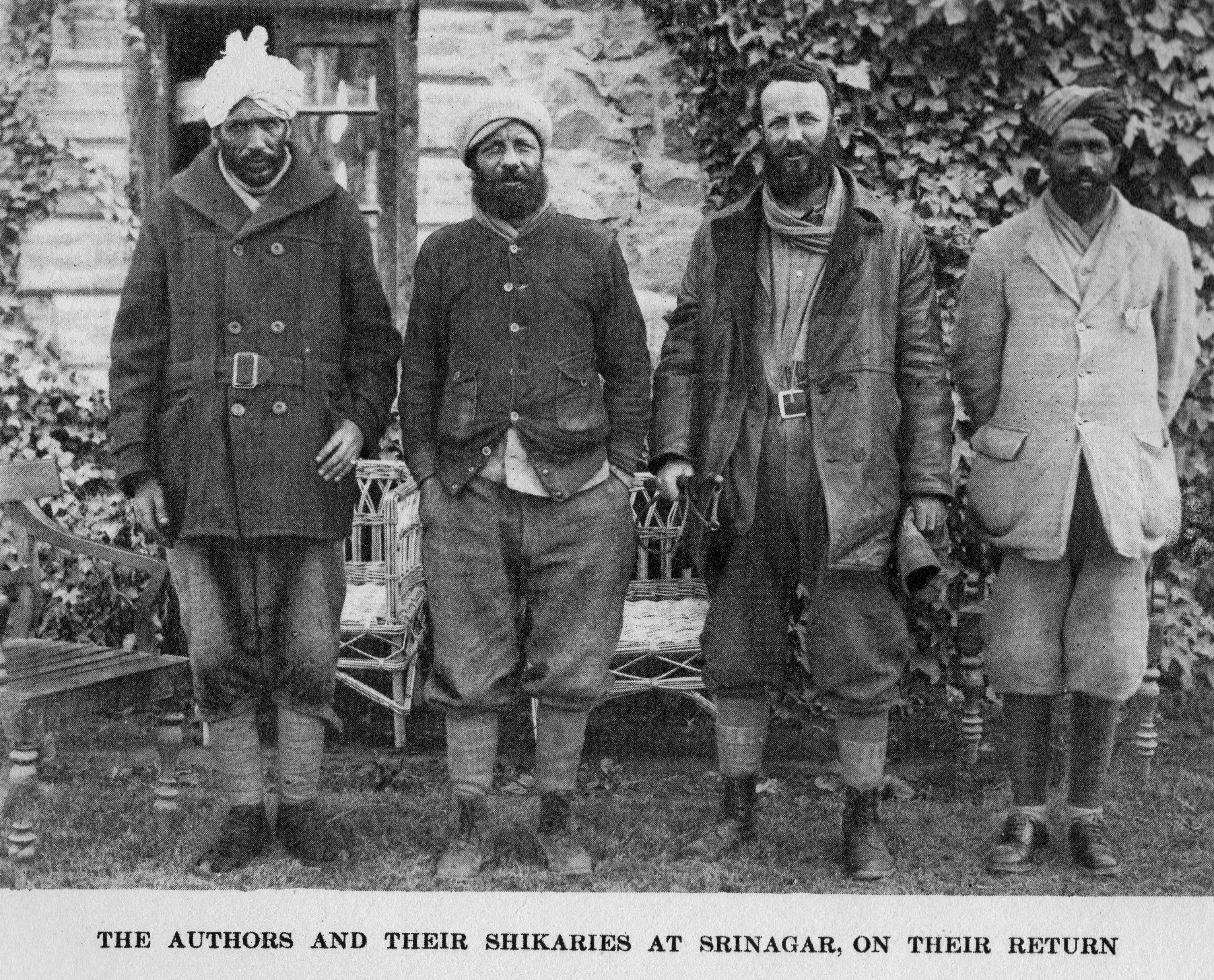
The search for the identity of the mystery hunter mentioned in previous posts continues. However, I think I have made a small breakthrough, in that I have been able to identify one of the shikaris (local hunting guides) that he used. Having drawn a blank on identifying the hunter himself – it does not appear to be Ellsworth Huntington, Percy Church, Captain HHP Deasy, Col. Charles Spurling Cumberland, Ralph Cobbold, Major RL Kennion, Capt. JNP Wood or any of the other well-known authors of books on hunting in the Pamirs and Central Asia – I set out to see if I could identify the shikaris he used. On the slides, one is named as Ramzana and the other as Rahima.
In the East of the Sun and West of the Moon (1926), a book written by brothers Theodore and Kermit Roosevelt about a specimen-collecting expedition they organised to the Pamirs in 1925 to collect mountain sheep for the American Museum of Natural History, they mention that one of their shikaris was called Rahima Loon. This immediately rang a bell, as the fourth magic lantern slide in the mystery hunter’s set of 87 is titled Rahima, my Shikari. This is it:
Mystery hunter’s slide ‘Rahima – my shikari’
Theodore Roosevelt, whose father was US President from 1901-1909, included as the frontispiece for his book a picture showing himself and his brother Kermit (in the middle of the photo), together with two shikaris. Inside the book there are further pictures of the shikaris, one of whom is named as Rahima Loon. Rahima Loon is on the right, with his brother Khalil on the left. There are further pictures of him in the book.
As you can see, there is a strong likeness between the two Rahimas, right down to the detail of the jacket they are wearing, which appears to be the same in each picture. Theodore ‘Teddy’ Roosevelt is effusive in his praise for Rahima. Referring to the quality of shikaris he says: “The best of these was Rahima Loon, our head shikarry. He had the dignity that is peculiar to the best type of Oriental. He was tall and slight, with a black beard and hawk nose. He knew game and its habits thoroughly. He also had courage…”etc.
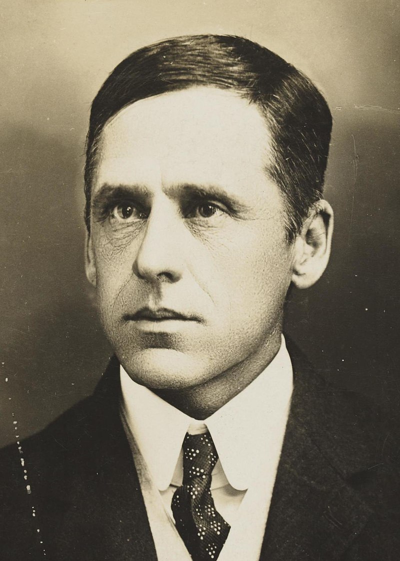
Roosevelt also mentions something else: “Thus, with Rahima and his brother Khalil, native hunters whom I had secured through Douglas Burden, the important members in our party were assembled. These last two had been Burden’s shikaries during a most successful hunting trip which he made a few years ago. He cabled them from New York and they were awaiting us in Srinagar…”. William Douglas Burden was a well-known collector for the American Natural History Museum and first brought Komodo Dragons to the USA. He also hunted at Abadabur in the Astor valley above the Burzil Pass for ibex and markhor specimens in 1923. My first thought was that perhaps Burden was our hunter. Below is a picture of him from the AMNH archive.
William Douglas Burden
Unknown hunter
However, as you can see, there is not a close resemblance to our hunter. I have also checked out Burden’s book, Look to the Wilderness (1956), in which he is profuse in his praise of Rahima, who, he says, was “one of the foremost travellers of Central Asia, whose diffident ways and steadfast persistence brought the rewards we were after.” Burden also mentions that he recommended him to the Roosevelts. Below is his photo of Rahima Loon, which matches the photos of our hunter and the Roosevelts – note the jacket.
Rahima Loon in a photo from Douglas Burden’s book Look to the Wilderness. Note the jacket.
Either way, the fact that we now know that the shikari Rahima Loon was used by both the Roosevelts and Burden places our timeframe more clearly into the early-mid 1920s, rather than earlier as I first thought. That he was highly thought of by American hunters may mean there were others who used him. Is there an association of shikari in Kashmir who may have records that go back to the 1920s? I wouldn’t be suprised. Anyone who can suggest further avenues to explore that would enable us to identify the hunter is welcome to get in touch.
Just in case you need cheering up in this cold weather! My good friend Amara sent me this video of his brother and nephew taking a winter ride across the open steppe in the Gobi-Altai region of Mongolia. What a place! Enjoy!
The Atkinson family has had more than its fair share of meetings with the great and good. Thomas Witlam Atkinson certainly met both Tsar Nicholas 1 and also Queen Victoria – a double that few others can match. His and Lucy’s acquaintances also included the Russian foreign minister Karl Nesselrode, Nikolai Muravyev-Amursky, the governor of Siberia, as well as his cousin General Michael Muravyev-Vilensky, the chairman of the Russian Geographical Society, and many senior members of the Russian aristocracy. Lucy Atkinson, we know, mixed with many celebrities in England, including the great geographer Sir Roderick Murchison and various literary luminaries, including the author, George Meredith. Their son Alatau Atkinson met with US President William McKinley whilst his son Jack was a close companion of the Prince of Wales (and future Edward VIII), who he taught to surf during a visit to Hawaii.
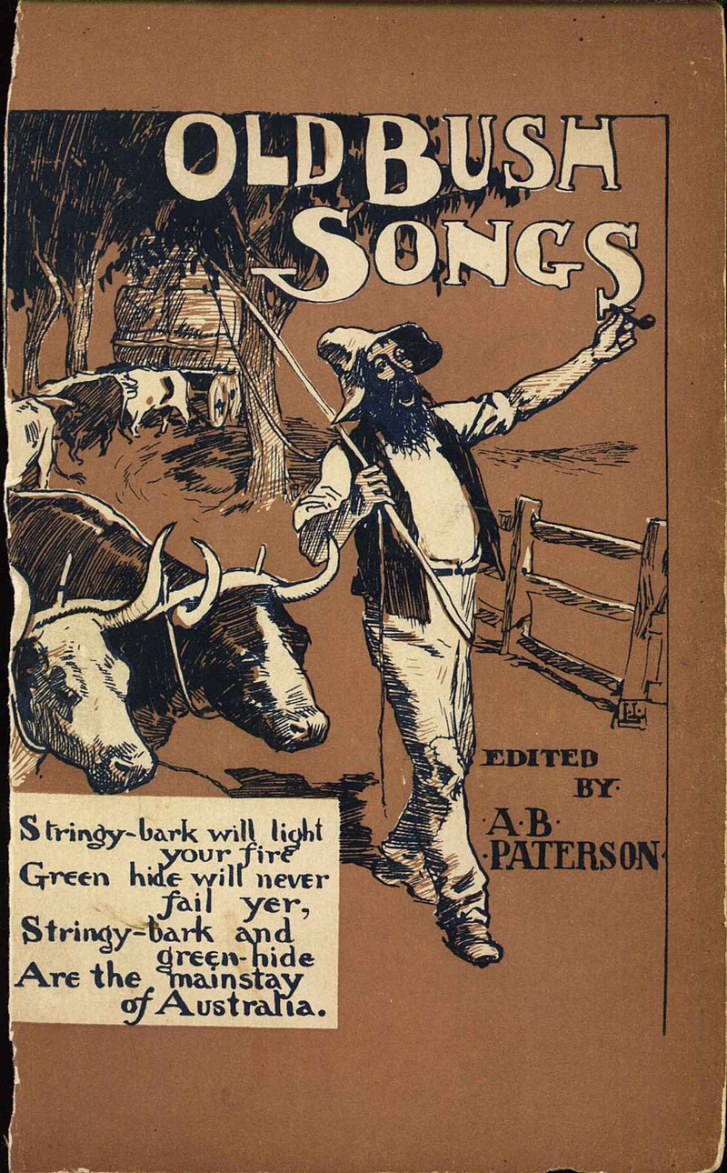
However, it has only recently come to light that Lucy’s siblings, seven of who emigrated to Australia during the mid-19th century, had a close relationship to Andrew Barton ‘Banjo’ Paterson (1864-1941), to this day Australia’s most celebrated poet and the composer of Waltzing Matilda, Australia’s unofficial national anthem.
Andrew Barton ‘Banjo’ Paterson (Mitchell Library, State Library of New South Wales)
Several of Lucy’s siblings settled in central western New South Wales, including Lucy’s oldest brother, Matthew Smith Finley (1811-61) who arrived in Sydney in 1833. In 1840 he and another close relative obtained a de-pasturing licence that allowed him to graze stock on Crown lands. At this point he was living at Buckinbah, near Wellington in the Lachlan District.
Those familiar with Banjo Paterson will immediately recognise the name Buckinbah as the station where the poet spent the first seven years of his life. Later he wrote that “This place was held on lease from the Crown at a few pence per acre, and was worth no more. It was dingo infested, unfenced country, where the sheep had to be shepherded, and the cattle, as the black boys [sic] said, could go ‘longa bush’ and wander afield until they got into somebody else’s meat cask, or could be mustered and driven away by enterprising people who adopted this cheap method of stocking up.”
Despite the hardships, this was the place that Paterson’s love for the Australian bush – to be expressed so compellingly in his ballads – was born. As his son Hugh was later to record, “You could sense it the whole time – that he loved Australia, and he loved the bush of Australia…”.
When Banjo was ten years old, he was sent to live with his grandmother in Sydney from where he made the daily trip across the harbour to Sydney Grammar School. After school, he served the customary articles of clerkship and was admitted as a solicitor in 1886. He had begun writing verses as a law student and his first poem was published in 1885. In 1889, sitting in his city solicitor’s office and yearning for the bush, he penned one of his most famous poems, Clancy of the Overflow, which includes the lines:
***
I had written him a letter, which I had, for want of better
Knowledge, sent to where I met him down the Lachlan, years ago,
He was shearing when I knew him, so I sent the letter to him,
Just ‘on spec’, addressed, as follows, ‘Clancy, of The Overflow’.
***
And an answer came directed in a writing unexpected,
(And I think the same was written with a thumb nail dipped in tar)
‘Twas his shearing mate, who wrote it, and verbatim, I will quote it:
‘Clancy’s gone to Queensland droving, and we don’t know where he are.’
***
In my wild erratic fancy visions come to me of Clancy.
Gone a-droving ‘down the Cooper’ where the Western drovers go;
As the stock are slowly stringing, Clancy rides behind them singing,
For the drover’s life has pleasures that the townsfolk never know.
***
And the bush have friends to meet him, and their kindly voices greet him.
In the murmur of the breezes and the river on its bars,
And he sees the vision splendid of the sunlit plains extended,
And at night, the wondrous glory of the everlasting stars.
…
And I somehow rather fancy that I’d like to change with Clancy,
Like to take a turn at droving where the seasons come and go,
While he faced the round eternal of the cashbook and the journal –
But I doubt he’d suit the office, Clancy, of ‘The Overflow’.
***
By 1895, ‘Clancy of the Overflow’ and other ballads were so popular that they were published in a collection, entitled, ‘The Man from Snowy River, and Other Verses’. The first edition sold out in the week of publication and 7000 copies in a few months. It established the bushman in the national consciousness as a romantic and archetypal figure. According to the Australian Dictionary of Biography Banjo Paterson “made balladry of the scattered lives of back-country Australians and immortalised them. He left a legacy for future generations in his…appreciation of the outback: that great hinterland stretching down from the Queensland border through the western plains of New South Wales to the Snowy Mountains – so vast a country that the lonely rider was seen as ‘a speck upon a waste of plain’.”
One of Banjo Paterson’s popular ballad books
‘The Man from Snowy River and Other Verses’ made Banjo Paterson a national celebrity overnight. His writing was praised as much in England as in Australia, with The Times comparing him with Rudyard Kipling, who wasted no time in writing from America to congratulate the publishers.
And what of the connection to the Atkinsons? Banjo’s rise to fame would have been of special interest to another of Lucy’s siblings, her youngest sister, Mary Ann (1831-1897) who in 1857 had married the pastoralist, Francis Smith. This marriage produced seven children, including the first daughter, Lucy Jane (clearly named Lucy after her aunt), who in 1884 married Arthur Sterling Barton. It will be remembered that Banjo Paterson’s full name was Andrew Barton Paterson – the Barton came from his mother Rose Isabella Barton who was an older sister of Arthur Barton. So, although Arthur Barton was only eight years older than Banjo, his marriage to Lucy Jane Smith made Lucy Jane an aunt to Banjo Paterson and the children of their marriage (Lucy Atkinson’s great nieces and nephews) Banjo’s first cousins.
Banjo’s writing skills were to take another direction with the outbreak of the South African War. He was commissioned by The Sydney Morning Herald and the Melbourne Age as their war correspondent and, in March 1900, was to be the first correspondent to ride into Bloemfontein. Here he finally met Kipling who in December 1901 entertained him as his guest in his Sussex home. The quality of Banjo’s reporting in South Africa attracted attention beyond Australian shores and led to him being recruited as a Reuters correspondent. On returning to Australia, he abandoned his legal practice and, with the interruption of the First World War, in which he commanded the Australian Remount Squadron (he was a superb horseman), he was to remain active in journalism until 1930.
It is always a pleasure to discover some new piece of work or article by someone you write about. So it was when I recently came across a pamphlet on the history of the exploration of the Pacific Ocean. Although there is no name on the cover, the pamphlet, Early Voyagers of the Pacific Ocean, as published by the Hawaiian Historical Society in 1893, is actually written by Alatau Tamchiboulac Atkinson – and catalogued as such by the University of Hawaii.
This little pamphlet, only 16 pages in length, is written in a lively and entertaining style in the first person. It tells the remarkable story Alvaro Mendana de Neira (1542-1595), one of the earliest Pacific explorers, whose two voyages led to the discovery of the Solomon Islands, the Cook Islands and the Marquesas amongst other places. He sailed from Peru westwards, which gave the Spanish valuable information about traversing the huge Pacific Ocean. de Neira’s final expedition to the Solomon Islands, where he died of fever after trying to establish a colony, is the subject of the Robert Graves novel, The Islands of Unwisdom.
Alatau’s bright and breezy style makes it clear that he was a natural storyteller. It is wonderful to be able to add this little jewel to his other writings.
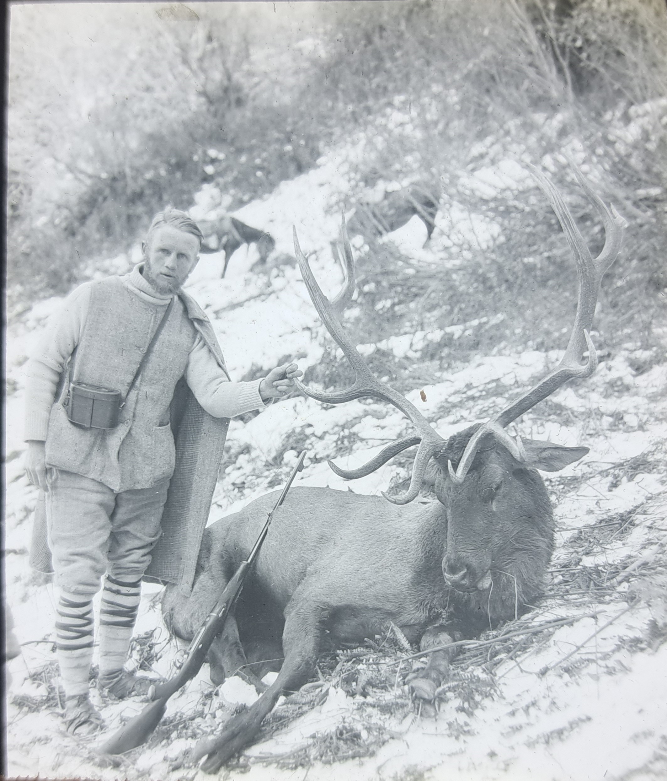
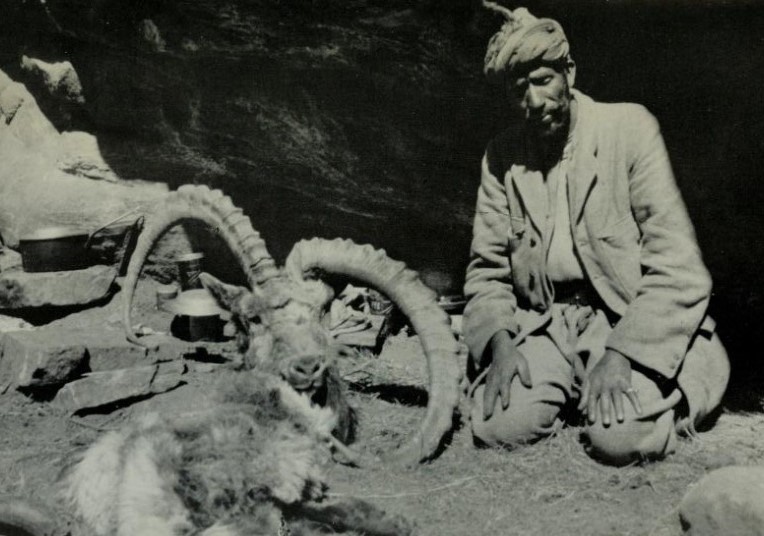
Regular readers will know that I have been posting copies of magic lantern slides taken by a hunter on a journey through Central Asia in the early 1900s. I have not yet been able to identify the hunter with any certainty, although there are several good candidates. We know he started off from Bandipur in Kashmir before making his way up the Astor Valley, crossing the Burzil Pass to Gilgit and then on to Hunza. From there he travelled to Atabad and across the Killik Pass onto the Pamirs. Then onwards to Kashgar, Maralbashi, Aksu and into the Tekes Valley where he hunted ibex, wapiti and roedeer in Burra Girgalam nullah and Amba nullah.
A yurt on the Pamirs
He then moved on to Koksu nullah, Kuldja, Sairam Nor lake, crossing into the Russian empire at Chuguchak. From there he travelled to Sergiopol (now Ayaguz in Kazakhstan) and Omsk in Siberia, the latter part of this journey in sleighs over deep snow. This was a tough journey by any standards. All that remains is to identify the hunter, who remarks that one of the Ovis Ammon Littledalei he shot was a record specimen at 57.5 inches.
A polo gathering in Hunza. Note the drummers.
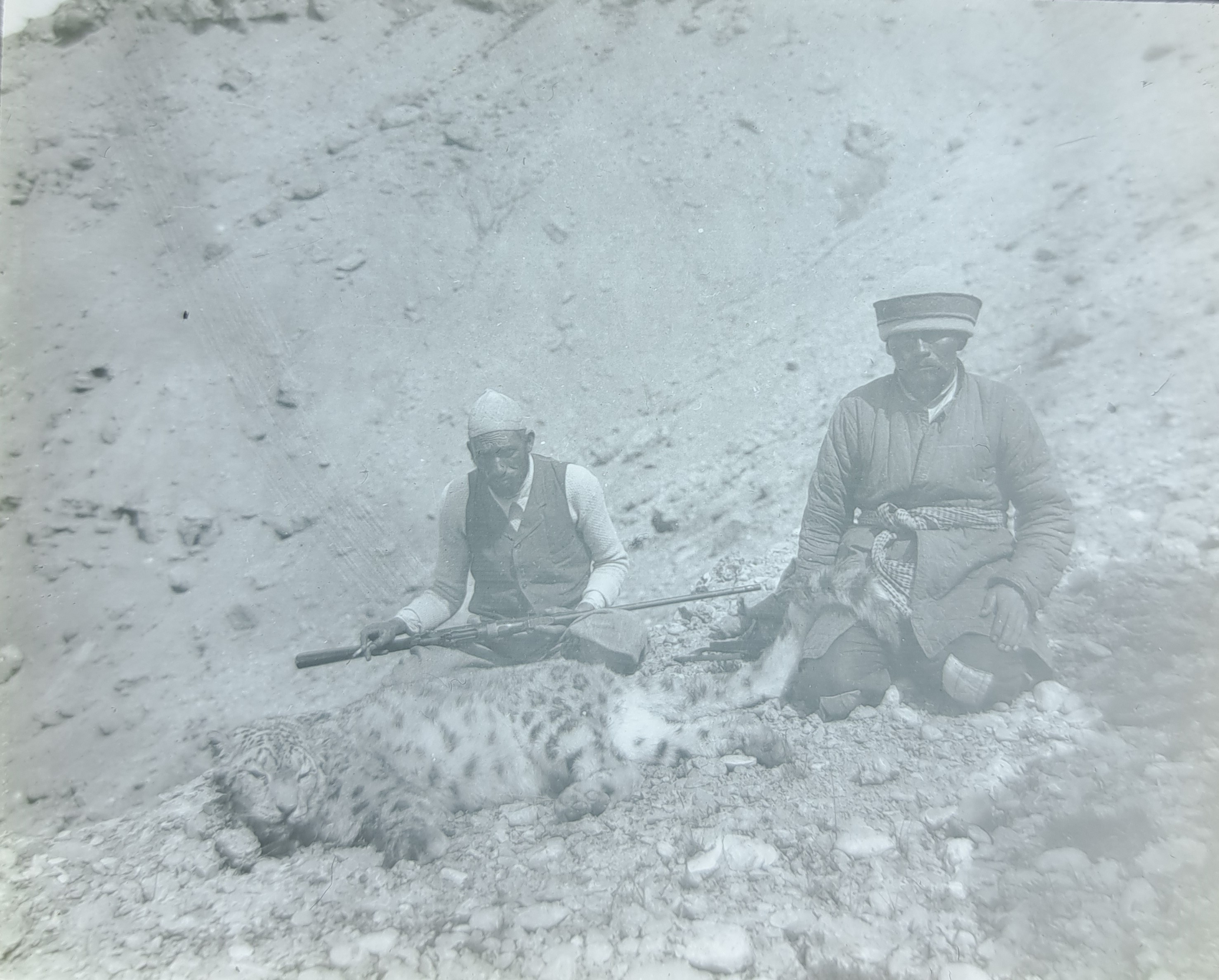
A snow leopard shot in the Pamirs
Once again, I urge anyone who can help identify the hunter to get in touch.
Thank you to those of you who have made suggestions as to the identity of the hunter whose collection of slides I recently obtained. We are getting closer, but I am not yet sure who he may be. I am adding a couple more portraits to see if they may prompt any further suggestions. The first is captioned “After wapiti in the Amba Nullah, Tien Shan“.
After wapiti in the Amba Nullah, Tien Shan
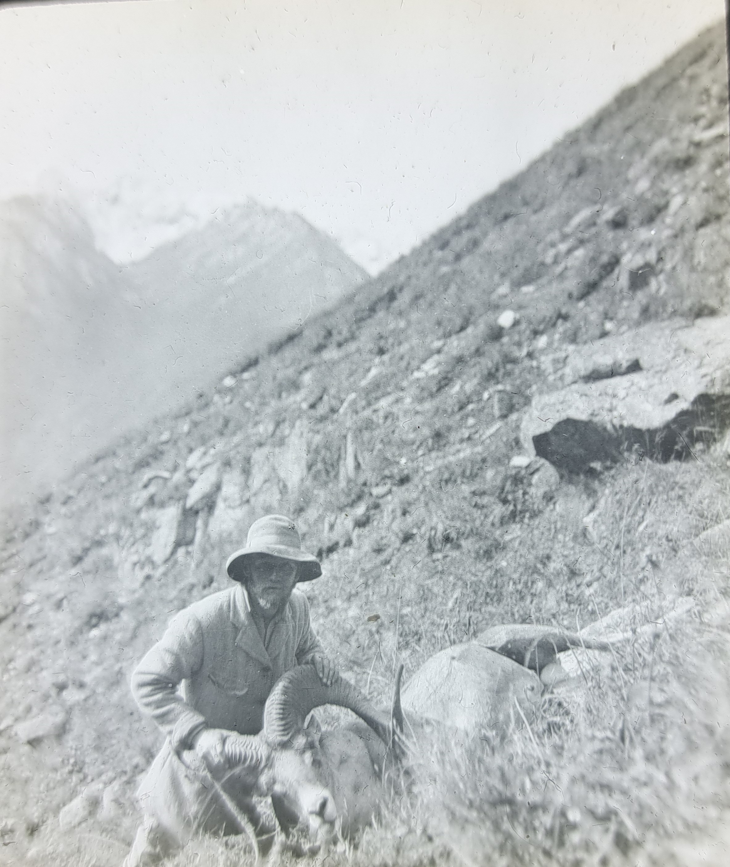
The second slide is entitled “Me with a poli on the Pamirs“. A ‘poli’ means an Ovis Ammon poli, ie Marco Polo sheep.
Once again, any assistance you can provide in identifying the hunter would be much appreciated.
For some time I have been collecting early photographic images of Central Asia. They are not easy to come by, not least because few people travelled in these remote regions and even fewer of them carried cameras. However, this week I was fortunate enough to obtain a stunning set of 86 magic lantern slides that illustrate a hunting trip through Central Asia and which date from about 1900.
Magic lantern slides
For those of you who do not know, the magic lantern was a precursor to the slide projector. A very thin photographic ‘positive’ measuring 3.25 inches x 3.25 inches was sandwiched between two sheets of glass and bound at the edges with tape. It was a primitive system, but often the quality of the photographs, mostly taken with plate cameras, was superb.
From what I can work out from the captions attached to each slide, the expedition leader – who I have not yet identified – set off from Srinagar in Kashmir, northern India, before heading north to Gilgit and Hunza. From there he crossed the Pamirs and then travelled on to Kashgar in modern-day Xinjiang. From there he headed to Aksu and then into the Tekkes Valley in the Tian Shan Mountains to hunt. He then made his way via the border crossing at Chuguchak (now Tacheng) into what was then Russian-controlled Turkestan, but which is now in modern-day eastern Kazakhstan. He passed through Sergiopol (now Ayaguz) before heading north into Siberia. By any account, this was a remarkable journey that required great stamina and determination.
In the Tekkes Valley, Tian Shan
Throughout this journey our traveller was hunting. The slides include his trophies, including ibex, Marco Polo sheep, roedeer, huge Asiatic wapiti or maral (red deer) and, sadly, snow leopards. One of the slides says that his Ovis littledalei had horns that measured 57.5 inches across, which he says was a record. But the real question is who is this person. Can you help? I know that it is not Captain HHP Deasy, who published In Tibet and Chinese Turkestan in 1901. Nor does it appear to be Percy Church, whose In Chinese Turkestan with Caravan and Rifle was published the same year, even though the route was very similar, as were the hunting trophies. However, I am reasonably sure that he is English.
A camel caravan that the traveller came across on the outskirts of Kashgar
So here are some pictures of the hunter. If you can help to identify him, please let me know. He is shown here with some of his hunting trophies.
Ovis ammon trophies
Asiatic wapiti or red deer
As you can see, his features are very clear. Please get in touch if you can put a name to the face.
Almost exactly a year after it received its world premiere at St Bartholomew’s church in Somerset, Alatau Atkinson’s beautiful little Christmas carol, Christmas Bells, has now been released on Spotify. It was performed again at St Barnabus’ Church in London SW18 last Sunday.
If you would like to download a copy of the carol, you can find it here.
Physical evidence of the Greek colonies in Central Asia, particularly in parts of Afghanistan and Tajikistan, is not easy to come by. The ancient river names Oxus and Jaxartes and even the southern Afghan city of Kandahar (‘City of Iskander’ ie Alexander) provide intangible evidence of a kind. Ancient coins bearing the portraits Greek kings with their famous elephant-head bonnets are physical reminders, as are the buried ruins of some of the Bactrian cities they built, such as Balkh, where finds have included intricately carved Corinthian columns. Occasionally, inscriptions in Greek turn up – as well as inscriptions in local languages written with Greek letters.
Demetrios I of Bactria
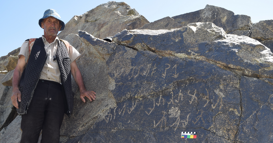
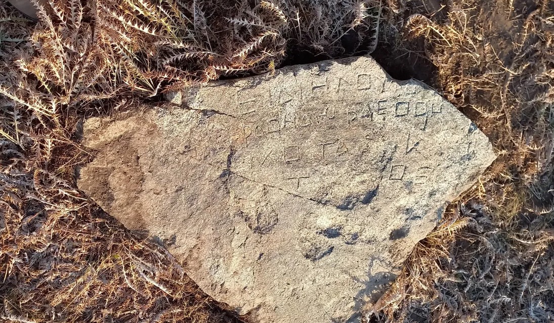
Thus there was considerable excitement recently when an unknown inscription in a script linked to Greek, but so far undeciphered, was discovered high in the mountains of western Tajikistan. The discovery was made by Sanginov Khaitali, a resident of the village of Shol in Hisor Sanginov district, who reported his find to local authorities. The inscription is in a gorge of the Almosi River, at a place known as Khoja Mafraj.
Sanginov Khaitali, with the inscription in the Almosi Gorge.
Here, at a height of almost 3,000m, archaeologists found a pyramidal rock outcrop with three lines of inscription, made up of 23 individual letters. There had been more, but earthquakes had shattered them – although some fragments were also found, including one with 36 letters carved into it. The letters on the first inscription are yet to be deciphered but are similar to an inscription found at Dashti Navur, near Ghazni in Afghanistan. The text on the second stone is written in Bactrian, but in Greek letters. It has been translated to mean “This is the …of the king of kings, Vima Tactu”. Vima Tactu was the son of Kujuly Kadfiz, the founder of the Kushan kingdom, who ruled about 89-90CE.
Location of inscription found in Western Tajikistan
According to Bobomulloev Bobomullo, from the Institute of History, Archaeology and Ethnography at Tajikistan’s National Academy of Science, “The discovery of new rock inscriptions in the Almosi gorge replenishes the archaeological map of Tajikistan with new monuments. Along with the famous inscriptions discovered from Surkh Kotal and Rabatak in Afghanistan, it is of world importance.” He says that next year a scientific expedition will continue to study the location of the inscription, where there is a large cemetery, and will also try to reassemble the fallen rocks to help recreate the entire text.
Secon fragment with a Bactrian inscription written in Greek letters
Recent DNA research has revealed that the Saka (Eastern Scythian) tribes that inhabited Eastern Kazakhstan for much of the first millennium BCE had connections to the Greek colonies further south, partly due to trade and partly due to raiding. This connection marks them off from the ‘Pontic’ Scythians of the Black Sea region and from Saka who lived further to the east. Eventually many of these Saka were driven south into the Bactrian kingdoms by nomadic warriors coming from Eastern China. Some of them then moved on into northern India.