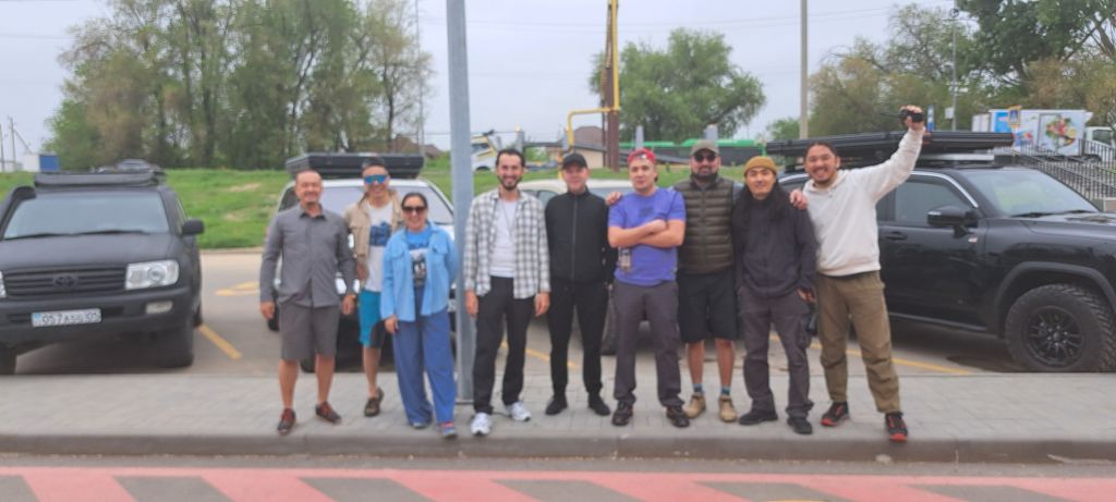
Today we left Almaty en route to the northern part of the Aral Sea, more than 1000kms to the north-west. Our expedition is being led by Dauren Raptayev, one of the most experienced travellers and explorers in Kazakhstan.
Travelling in four SUVs, we will spend about 8 days exploring the lake and surrounding areas. More info soon.
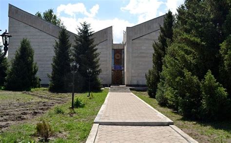
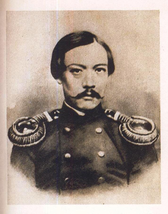
As the editor of the English language Selected Works of Chokan Valikhanov, it has long been my wish to visit the Altyn Emel Memorial Museum dedicated to this great 19th century Kazakh in the village of Shokan in the Altyn Emel region of south-east Kazakhstan .
The museum is about 2 hours outside Almaty, close to the Altyn Emel national park, and about 5kms from the actual burial place of Valikhanov, who died there in 1865.
Valikhanov’s writings in English
The museum building itself is unique and was designed by architects A. Seydalin, B. Ibraev and S. Rustambekov. All corners of the unusual building are of different sizes, with beams that descend into the centre, passing into a “knot of happiness”, woven from colored cords.
Internally, the visitor walks into a main hall, all the time ascending in a spiral until a top gallery is reached. The hall is dominated by a huge woven carpet illustrating elements of Valikhanov’s life. Mangyshlak limestone is used in the decoration of the facade of the building – a soft, pliable pink stone.
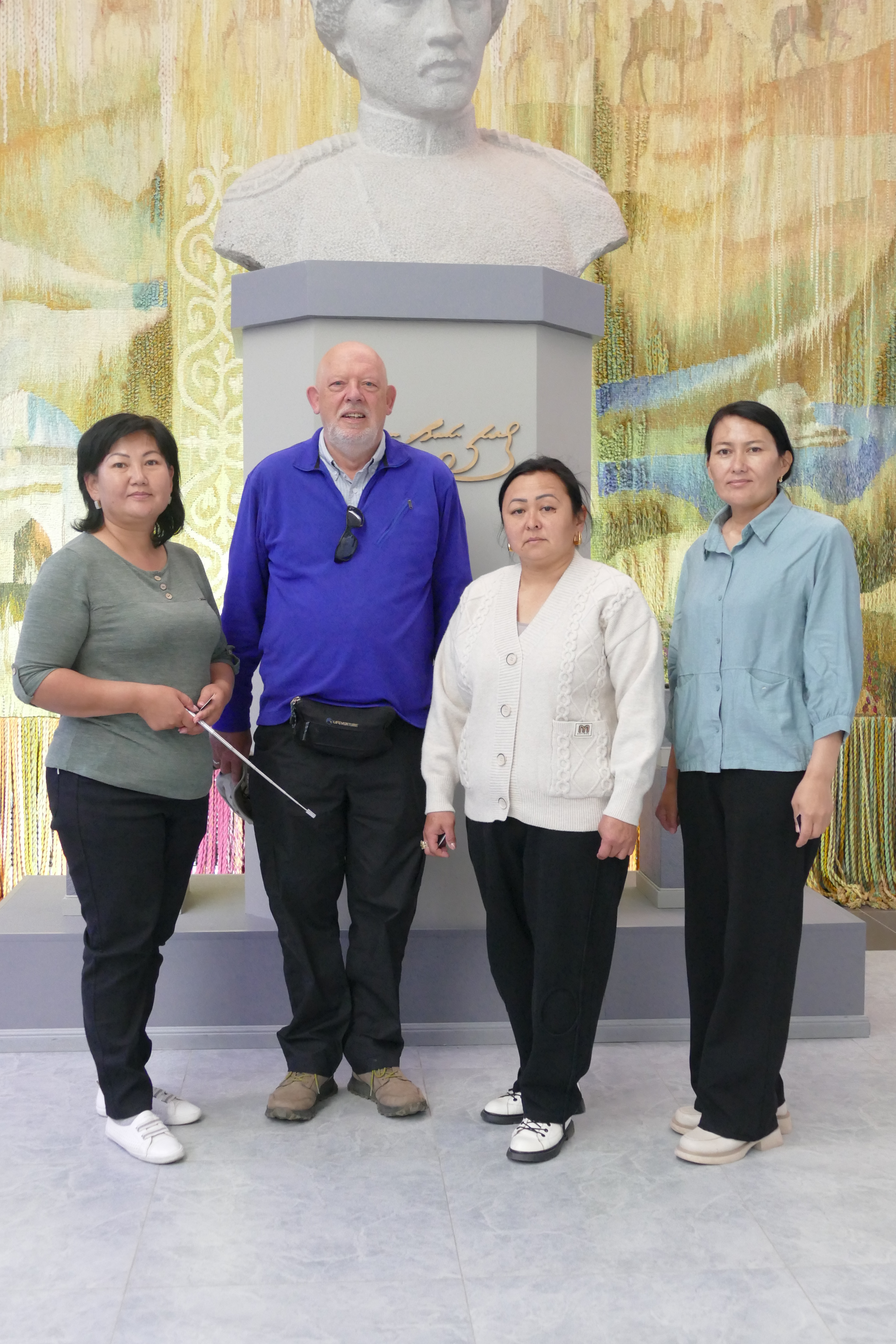
I was introduced to the director, Maral Rahatova, who kindly asked me to sign the visitors’ book and pose for a photograph with the staff. The museum itself contains a number of items that once belonged to Valikhanov, including his tiny pistol, gilded in gold, his tea bowl and various items of his clothing.
Valikhanov’s pistol
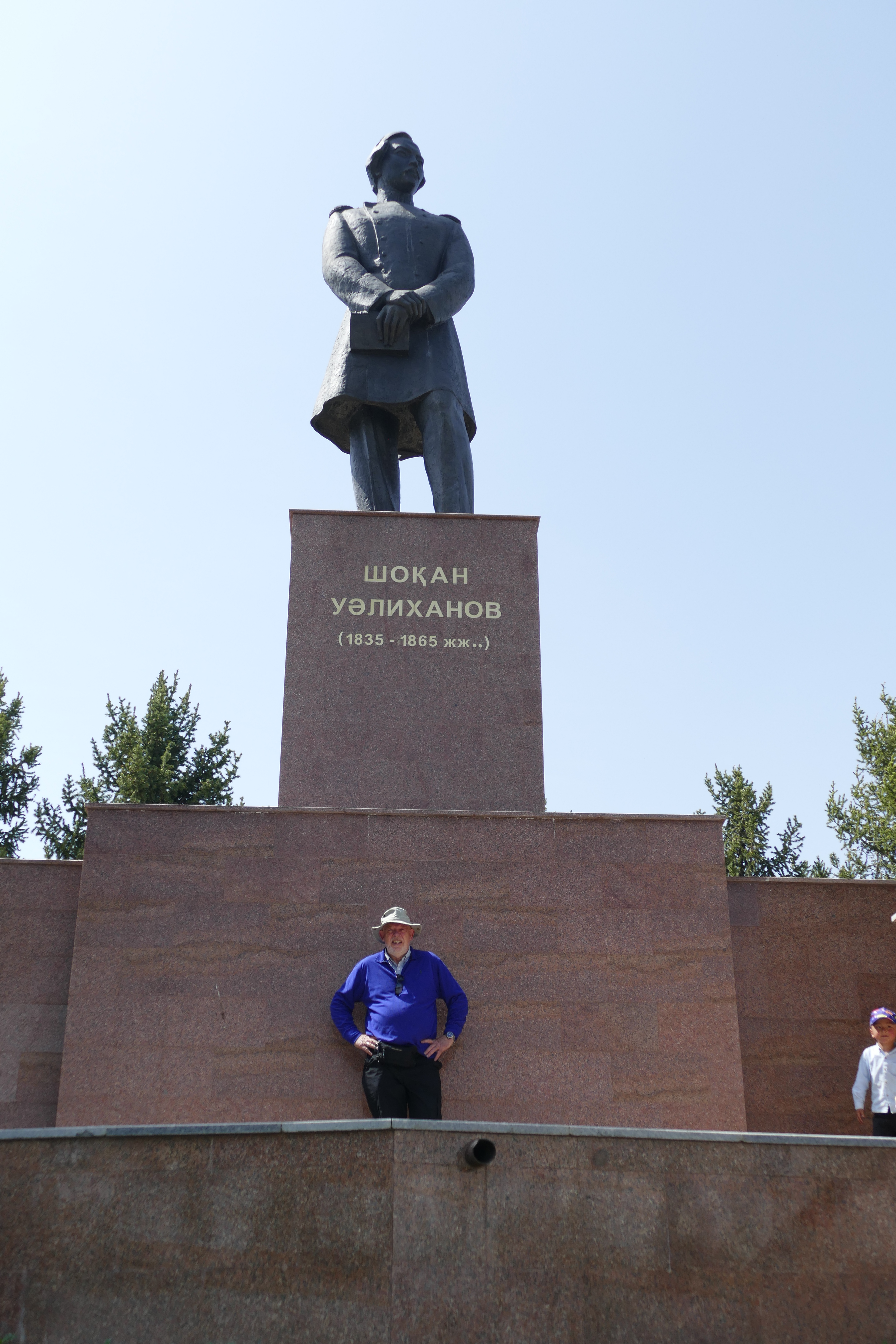
Outside the museum is a large bronze statue of Valikhanov that dominates the area. And a few kilometres away is his actual burial place, where he died – probably of TB – aged only 29, in 1865.
Statue of Valikhanov outside the Museum
The burial place of Valikhanov
All-in-all, this was a wonderful visit. Although it is a bit remote, anyone visiting will find it well worth the journey. If you want to know more about this great thinker and historian, track down a copy of my book, or you can read it online here.
My article on the story of Aru Sultan, the young Kazakh woman brought back to England from Central Asia by the Elizabethan merchant adventurer Anthony Jenkinson in 1560 has now been published by Qalam magazine. You can find a copy here.
Qalam is a multi-media project founded by Timur Turlov, a successful Kazakh entrepreneur and financial expert and founder and owner of the publicly traded company Freedom Holding Corp. Timur Turlov invests in IT startups in Kazakhstan, actively supports a number of charitable and social projects in the humanitarian, public and sports spheres. Since January 2023, he has been head of the Kazakhstan Chess Federation.
Literature about the southern Siberian territory of Tuva, just to the north of Mongolia, is not easy to come by. The Austrian Otto Mänchen-Helfen, an expert on the Huns, is one of the very few authors who have written with authority on the culture of the Tuvans. He was the first non-Russian to visit the region – whilst he was teaching at the Marx-Engels Institute in Moscow in the late 1920s. His book Journey to Tuva,[i] first translated in 1992, remains a classic.
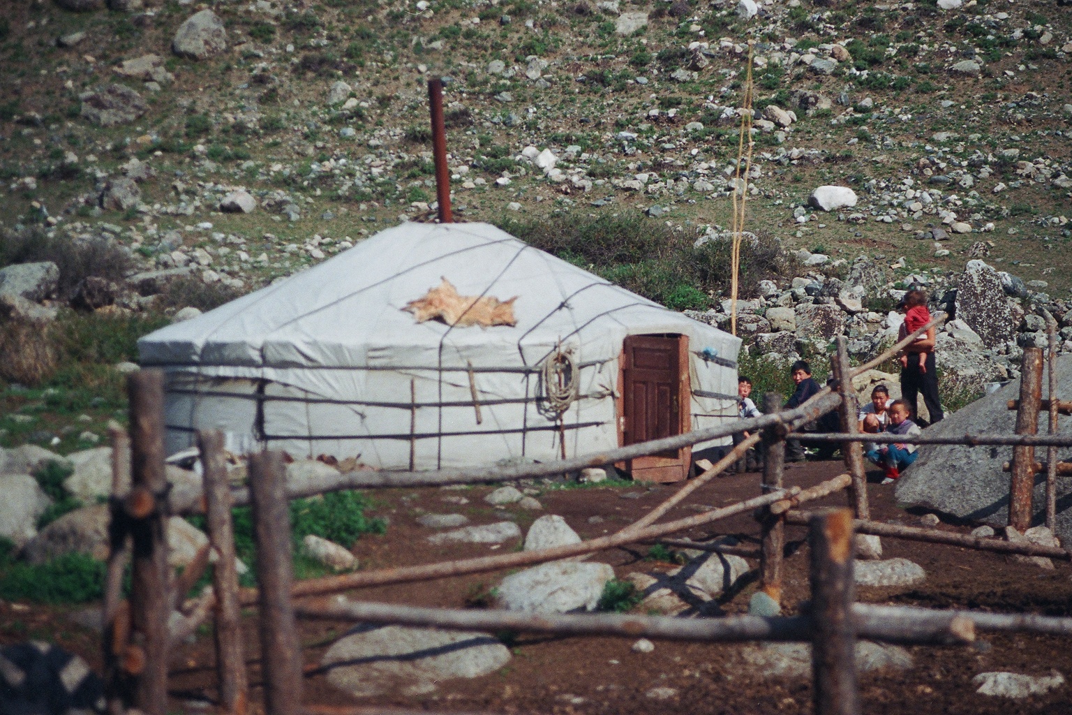
A horseman carrying a sheep in the Western Sayan mountains of Tuva (author’s photo).
The English traveller and author Douglas Carruthers, who travelled through north-western Mongolia, Djungaria and Tuva in the years before the First World War, and who wrote the impressive two-volume Unknown Mongolia,[ii] was another of this rare breed. Otherwise, there is little. Ralph Leighton’s Tuva or Bust! Richard Feynman’s last Journey, for example, is about the famous mathematician’s desire to visit Tuva (never accomplished), rather than the country itself.
Thus it was a pleasure to come across a 2023 essay in English about the Khakassian scholar and Turkologist Nikolaj Fedorovich Katanov (1862-1922), who was the first person to study the language and culture of the Tuvans.[iii] The Russian researchers who have uncovered his story have had to search through archives in Kazan, Moscow, St Petersburg and various non-Russian institutions to gather material.[iv]
Katanov was a professor at Kazan University where his research into the languages of southern Siberia was ground-breaking. His expedition to the region in 1889-1892 to study languages and ethnography was financed by the Russian Geographical Society, the St Petersburg Academy of Sciences and the Ministry of Public Education. It resulted in his A Study of the Uriankhai Language. Sadly, a comprehensive report on the expedition was never published, although a selection of the hundreds of folk tales he collected was published in 1907.
Without a detailed final report, the best source of the author’s work is his diaries. The first of these, which covers the first stage of the journey to Tuva, was only published in (in Russian) 2011. Another diary that describes Katanov’s stay in Khakassia and his first trip to Semirechiye and Tarbagatai (now both in Kazakhstan) and Xinjiang in 1890 was only published in 2017. Other diaries, so far unresearched, lie in the state archives of the Republic of Tatarstan. The diaries for his winter expedition to Hami and Turfan in Xinjiang have not survived. There is also a question about the location of the photo archive taken by the photographers Vasiliev and Tolshin during the expeditions, which does not seem to have been found to date.
Typical yurt in the Western Sayan Mountains of Tuva (author’s photo)
In the St Petersburg archives of the Russian Geographic Society there is a “A Letter with a Brief Overview of the Trip to the Semirechensk Region in 1891-1893’ and several other documents.[v] Other documents were published later in Germany and America, including Folk Texts of East Turkestan from the Legacy of N F Katanov, published in East Germany in 1973.
Many of Katanov’s letters did survive and these now provide more details of his life and work, although they have not yet been collected and published, with a few exceptions, including those to the Russian Academician V V Radlov, who was deeply impressed by their content. The authors of this paper say that in the coming years all Katanov’s letters to St Petersburg Orientalists will be published as part of a project to publish the lifetime work of this pioneering author, who has been largely forgotten because of the policies brought in by the Soviets that resulted in the widespread destruction of Turkic culture during the Stalin years.
[i] Mänchen-Helfen, Otto, Journey to Tuva, Ethnographics Press, Los Angeles, 1992.
[ii] Carruthers, Douglas, Unknown Mongolia: A Record of Travel and Exploration in North-West Mongolia and Dzungaria (2 vols), Hutchinson & Co, London, 1913.
[iii] Valeev, Ramil M et al, ‘The Heritage of NF Katanov and the Prospects of its Study: Diaries and materials of his Travel to Siberia and Xinjiang (1889-1892),’ Written Monuments of the Orient, Vol 9, No 1 (17), 2023, pp36-49. DOI: 10.55512/wmo465708
[iv] The only work in English that touches on some of the same areas is Gold Khan, (trans. By Norman Cohn, Secker and Warburg, London, 1946). This is a series of heroic legends from the Koibal, Katchin and Sagai tribes of Khakassia (to the north of Tuva) collected in the mid-19th century by a group of philologists travelling in the Minusinsk District.
[v]Archive of the Russian Geographical Society, Category 87, Op 1, No 15, 2l.
The two tigers that arrived in the Ile-Balkash Reserve last September have begun to mate, as can be seen in the film clip above. Nine-year-old Kuma and 12-year-old Bohdana appear none the worse after surviving their first winter in Kazakhstan. As can be seen in the video, there is still snow on the ground in their compound.
These two tigers arrived from a zoo in Holland and neither of them have ever spent time in the wild. It is unlikely that they will ever be released, as they lack the hunting skills needed to survive. However, any cubs they produce will be kept away from humans and released into the Reserve to fend for themselves when they are about two years old. Tigers give birth after about 20 weeks, so any cubs should be born in July.
During the cubs’ first two years, whilst they are still in captivity prey species such as deer and wild boar will be introduced into their compounds so that they can learn to hunt. This will equip them for life in the Reserve once they are released.
Up to five further tigers from Russia should be arriving in the 415,000-hectare Ile-Balkash Reserve this year. After a short period in compounds they will be released directly into the Reserve and it is hoped they will become the nucleus of a breeding population that could eventually reach more than 100 animals.
Tigers were once common in Central Asia, where they were known as Turanian tigers or Caspian tigers. They are genetically indistinguishable from the Siberian or Amur tigers that inhabit the far east of Siberia. All the tigers being taken to Kazakhstan are from this subspecies, which is adapted to withstand the harsh winters that can see temperatures fall as low as -40 degrees C. Numbers declined due to hunting and poaching and the the last ones were killed in the mid-1950s.
In the most recent issue of Asian Affairs, the journal of the Royal Society for Asian Affairs, editor Bill Hayton notes that it is unusual to receive three unsolicited book reviews for the same book. He was referring to David Chaffetz’s brilliant new book Raiders, Rulers and Traders: The Horse and the Rise of Empires[1], which fully deserves the attention it is now receiving.
Chaffetz argues, very convincingly, that to understand the vast interconnected system of trade routes that once constituted the ‘Silk Road’ we need to understand the fundamental role played by the trade in horses in particular. “No animal has had as profound an impact on human history as the horse,” he says. Domestication provided a source of both meat and nutritious milk, as well as transport. Horses regularly needed fresh pastures and this in turn provided the basis for pastoralism as a system that came to dominate the steppe regions.
Thus it was horses, rather than silk that dominated the Silk Roads. Chaffetz shows how the demand for horses bred on the Eurasian steppes came initially from the Chinese and then later from the Mughals and other dynasties in India. Chinese traders travelled as far as Iran, Afghanistan and the Ferghana Valley in present-day Uzbekistan in search of good horses that would give the northern Chinese huge advantages in their military campaigns against their neighbours to the south. As the Chinese Han General Ma Yuan remarked in the 1stC CE, “Horses are the foundation of military power, the great resources of the state…If the power of the horse is allowed to falter, the state will totter to a fall.” With the horses came men from the steppe to develop cavalry brigades and these men too eventually became powerful in their newly adopted homelands.
Mobile horsebreeders helped to connect the world in these early days, bringing sedentary agricultural societies in contact with one another: “Arts, religious beliefs, sports and fashion spread from one end of the old world to the other in the saddlebags of the steppe horsemen,” says Chaffetz. “The horse itself became both a vehicle and a symbol: gods manifested themselves upon them, kings were buried with them, princesses rode them in polo matches and poets praised them in verses that local schoolchildren still recite.”
Although settled peoples quickly began to breed their own horses, the steppe dwellers always held an advantage in the vast open spaces they inhabited. It was hardly surprising that at a certain point a steppe-based empire was able to take on the rest of the world – and win. Genghis Khan’s Mongol empire was the high watermark for the horsebreeders, until gunpowder put an end to their advantages, but not before both the Mughals and the Manchus had also built substantial empires on the back of horse power.
The impact of horses in Western Europe was far less significant. Horses were also used in battle, but usually only by the elites of mediaeval society and later by fancy cavalry regiments. If the peasants could afford a horse, its main use was in agriculture for ploughing – something no self-respecting steppe dweller would ever consider. The typical agricultural labourer could seldom afford to keep a horse. Without the open steppe and its limitless pastures, Western Europe could not sustain large number of animals reliant on grazing.
On the steppe in contrast, everyone rode, women included. And a huge mobile army could be raised in days using the ‘arrow’ system developed by the Mongols. Each rider provided his own horses and learned from childhood how to manoeuvre and perform complex cavalry attacks.
Chaffetz remarks that until now the importance of horses in the development of society has been either overlooked or underestimated by historians. That began to change with the break-up of the Soviet Union, which allowed Ukrainians, Kazakhs, Mongols and other horse-orientated societies to reexamine their histories and to make use of advances in carbon dating and DNA analysis to provide new insights.
The Silk Roads exhibition now showing at the British Museum in London, whilst illustrating the extent of trading links in the ancient world, makes little reference to the importance of horses. It is a pity that its organisers were unable to make use of Chaffetz’s superb research. Those of you who are members of the RSAA may well already have booked a seat for his talk (in person) on 22 January in London. Either way, this book is a must.
[1] David Chaffetz, Raiders, Rulers and Traders: The Horse and the Rise of Empires, WW Norton, New York, 2024, ISBN 978 1 3245 05146 6.
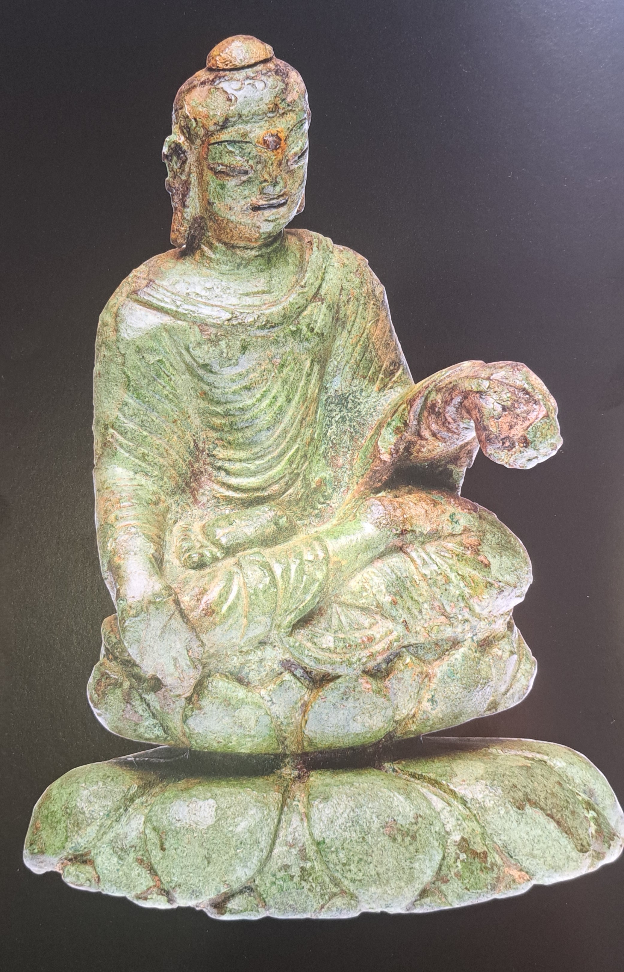
As you walk into the British Museum’s new Silk Roads exhibition the first thing that confronts you in in the otherwise empty entrance hall is a tiny copper alloy buddha only three inches high. The buddha dates from the 6th or 7th centuries CE and was probably made in the Swat Valley in what is now northern Pakistan. But what is remarkable about it is the fact that it was found on the small lake island of Helgö in Sweden from archaeological levels that date to around 800CE.
There in a nutshell is the intellectual proposition that lies beneath the exhibition – that the ‘Silk Roads’ were not simply about camel trains laden with precious consumer goods making their way westwards across the deserts and mountains between China and Europe. No, this is about the extraordinary level of connectedness that existed in ancient history and that trade goods travelled by both land and sea along transport links that spanned most of the known world.
Ever since the German geographer Ferdinand von Richtofen invented the term Seidenstrasse in 1877 the term has had a specific meaning – in part connected to the accounts left behind by travellers such as Marco Polo – of a number of trade routes that start in Western China and progress through the Taklamakan Desert in Xinjiang, across the Pamirs and Hindu Kush towards Iran and then on from there to the Mediterranean coast.
The late 19th– early 20th century discovery of huge numbers of remarkable artefacts at ancient buddhist sites in Xinjiang by such luminaries as Sir Aurel Stein and Albert von Le Coq only added to the attraction of this idea as a way of explaining the importance of international commerce in world history. But as Warwick Ball has pointed out, doubts over the use of this concept have been around since at least the 1940s, when Owen Lattimore refuted the idea that Xinjiang was deliberately opened up by the Chinese to export silk.[1] Hugh Pope called the idea “a Romantic Deception”, while Susan Whitfield, currently Professor of Silk Road Studies at the University of East Anglia, opened her 2020 book Silk Roads with the words “There was no ‘Silk Road’”.[2]
So anyone arriving at the exhibition and looking for vistas of Samarkand and Bokhara or pictures of caravanserai and shaggy Bactrian camels is in for some disappointment. And please note, almost everything on show dates from between the 5th and 10th centuries CE, a period in history about which very few people have a good grasp. Who was ruling China, Central Asia and the Middle East during these turbulent years? And even though the garnets in jewels recovered from Anglo-Saxon burials such as Sutton Hoo likely came from mines that were thousands of miles to the east, little is known about the nitty-gritty that underlay the trade in these kinds of luxury goods.
However, that being said, the curators of this exhibition have been able to give an indication of the extent of international trade during this period of history. They show that trade was not simply east-west, but that north-south interactions were equally important, as was Central Asia’s connection to India. Nor was it simply trade goods such as silk and jewels that were exchanged. War tactics, social customs, diplomacy, pilgrimage, literature and other cultural artefacts were also exchanged over vast distances. Maritime routes, such as those in the Baltic, the Red Sea and Indian Ocean were also central to this interchange of goods and ideas.
Great social transformations, including the expansion of Islam from the 7th Century, the growth of the Tang Dynasty in China, the end of the Roman Empire and the growth of Byzantium and the expansion in the Holy Roman Empire under Charlemagne were also important factors in determining trade routes and exchange objects. This was a time when Christianity, Islam and Buddhism were all expanding.
Small glass cup from Alexandria
So it is hardly surprising that visitors to the exhibition will hear about places never before mentioned in relation to the Silk Road. Heijo-kyo in Japan, Silla in Korea and Chang’an in north-central China are placenames that are unlikely to be on the tip of one’s tongue. And yet the objects found in each of these places tell remarkable tales. Take the small blue glass cup found at Cheonmachong Tomb at Gyeongju in Korea. It dates from the early sixth century and has a honeycomb-patterned decoration produced using a mould-blowing technique. Such glasses can be found across Roman territory, but it was probably made at Alexandria in Egypt.
Items recovered from shipwrecks in the Indian Ocean also provide an insight into ancient trade. During the period in question ships sailed from northern China via the Indonesian islands to India, Persia, Arabia and the east coast of Africa. In 1998 the wreck of the Tang Dynasty ship now known as the Belitung was found near Sumatra, comprising more than 60,000 pieces of Tang ceramics and other objects that date to the 9th Century CE. It was probably on its way back to the Persian Gulf when it sank. Its cargo provides a great cross-section of commercial goods from the period.
The Miraculous Image of Liangzhou
The discovery in 1900 of the Dunhuang caves in the Tarim Basin of Xinjiang provides another great source of trade goods. In Cave 17 Aurel Stein found (and bought) 70,000 manuscripts, paintings and other objects, several wonderful examples of which are in the exhibition. These objects transformed the way in which the culture and history of this region was understood. The Miraculous Image of Liangzhou, more than 2.5 metres in height and embroidered with silk thread on silk and hemp, is one such item.
The exhibition never ceases to amaze the visitor as it demonstrates the extent to which our ancestors traded with one another. Khazars, Vikings, Alans, Eritreans, Sogdians and many other societies knew of each other and sent trade goods huge distances.
So at the end of the exhibition what can we say? The Silk Road is a misnomer? Yes! It was never a single road? Yes! Trade was in both directions, not to mention north and south and often by sea? Yes! In other words, we are talking about international trade and exchange of ideas. It was a phenomenon not restricted to one part of the globe – if we exclude South America – or one culture. But are we throwing the baby out with the bathwater? There is a danger that in generalising our understanding of the Silk Road to include just about all international trade we lose the very specificity that made it a powerful idea in the first place. More than likely that is what is happening. Scholarship on the Silk Road has now outgrown the original subject and awaits a new definition and focus. But for now, go along and see the incredible exhibits. It is crowded and you cannot easily move from one glass case to another, but it’s almost worth the entry just to see that tiny little buddha.
[1] Warwick Ball, The Eurasian Steppe: People, Movement, Ideas, Edinburgh University Press, Edinburgh, 2021.
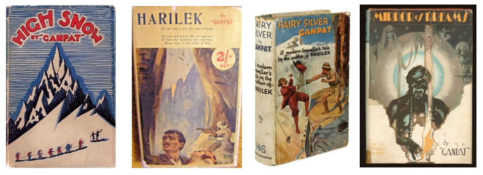
Over the past few years I have come across dozens of novels that are set in Central Asia. Most date from the end of the 19th century until the 1930s and reflect that period when the last few unexplored places were gradually being discovered and mapped. Many of them are in the form of what are generally known as ‘Lost Race Novels’. These usually take the form of a group of modern travellers finding a ‘lost’ community living in an isolated valley away in the mountains. The original story of Shangri-La is the most well-known of these novels. Others feature lost tribes, lost Vikings, lost Greeks and Romans, even lost Crusaders. Many are characterised by their lurid cover art. So far I have found over 120 such novels based in Western Asia, in which I include the mountains of northern India and Tibet.
I have now written an article summarising what I have found so far and including as many of the covers as possible. You can find a link to my article here:
Today I am publishing an essay (4,000 words) about Anthony Jenkinson, an Elizabethan merchant who was the first Englishman to sail on the Caspian Sea and the first to visit the city of Bukhara. Jenkinson is famous for his superb map of Western Asia. Less well known is the story of Aru Sultan, the woman he brought back from Central Asia and who became a lady-in-waiting to Queen Elizabeth I and an innovator in fashion. Some historians argue she was an emissary from the Kazakh khanate to England, charged with opening up a trade route that would see the Silk Road traffic diverted away from the Mediterranean to England. You can read it below:
Asian Textiles, the magazine of the Oxford Asian Textile Group, has just published my article on saukele, the tall hats worn by several different ethnic groups in Central Asia, including the Kazakhs, Kyrgyz and Qaraqalpaqs. The article goes into the background history of this fascinating item of clothing, and shows that it has a long tradition stretching back thousands of years. The tall hats worn in Western Europe during the Middle Ages in all likelihood were derived from a version of the tall hats worn by Kipchak/Mamluk women in the Middle East. You can read a copy of the article here.